Overview
Camping Trip 2000 was the longest camping voyage I have made to date. Maybe someday in the future I will take a longer one. Maybe not. (I did! See National Parks Tour '04.) At any rate, I started out from Tucson, AZ on the 17th of July and finished when I drove into my sister's driveway on the 12th of September. In between I visited ten U.S. states and one Canadian province. I stayed in 22 different campgrounds, spending a total of 44 nights either in my tent or the van. I visited friends in 3 places; San Diego, near Salem, Oregon, and just outside of Denver, Colorado.
When I returned to the States from Brazil I had gone up to Wisconsin to visit my sister and brother-in-law. They had already arranged the loan of a Dodge Ram cargo mini-van for my stay in the U.S. I drove it back to Dallas, then out to Tucson where I used it during the two months I spent there visiting friends and my home church. While there, I modified the van by adding an eight-foot shelf in the back to increase the carrying capacity and variety. When I left in July, the van was loaded with my tent, two sleeping bags, suitcases, a toolbox, two ice chests, a water jug, a Coleman stove and Coleman lantern, and much more.
It was an unusually dry summer. As the beginning of August rolled around, fires raged in the northern states, especially Montana. I ended up getting kicked out of one campground because the Forest Service was closing all recreation sites due to fires. Nevertheless, I did manage to visit Yellowstone and Grand Teton Parks, and was always able to find at least one available campsite. I drove on every kind of road imaginable, from Interstate freeway to one dirt track so bad that I thought it would damage my suspension.
As the end of August came I entered Colorado, and the weather decided to make up for the earlier lack of rain with a vengeance. At least I no longer needed to be concerned about campgrounds being closed due to fire danger.
After my last “people visit” I put the van into high gear and raced east, just stopping long enough in South Dakota and Minnesota to spend the night (except for a couple of hours I spent taking a quick look at Badlands National Park). I left Minnesota heading north into Ontario, with the intent of driving around the north shore of Lake Superior. After three days up in Canada I returned to the States, headed to Wisconsin, and after a brief visit to Eagle River, I headed back to my sister's to return the borrowed van. The trip was over, but the memories will remain forever.
Here are the details of my trip, state by state. Unfortunately, there are only a few pictures—all either taken at earlier dates or else borrowed—as I still did not have a new camera.
July 17 - 20: Arizona
Wildernet – Arizona
Arizona Highways
If you have never been to Arizona, you may have the idea that it is nothing but sand and cactus. Nothing could be further from the truth. In reality, Arizona possesses just about every type of climate imaginable for a temperate zone, ranging from hot deserts to cool forests and meadows. There are sections of highway that are as green as the Pacific Northwest. There are lakes and rivers. The key to the differences is altitude.
In the eastern portion of the state, north of Interstate 10 but south of an east-west line passing through Phoenix, lies the Apache-Sitgreaves National Forest. Much of the forest sits at altitudes of 7000 to up to 10,000 feet. In the winter, it is covered with deep snow. And even in the summer it is much cooler than the desert, up to 30 degrees cooler; more if it is sunny “down below” and raining up in the mountains, as it often is.
I began my trip on the 17th of July, driving out of Tucson on Interstate 10, heading east. The road dips south, passes through Benson, then curves north again. On the eastern side of the Pinaleño Mountains, U.S. highway 191 leads up to Safford. From there I continued northeast, through rolling desert, until I reached the mining towns of Clifton and Morenci.
Around Clifton and Morenci the road climbs steeply, winding around mountainsides hither and thither. It continues for a long way like this, climbing, then descending, then climbing again, until after nearly 50 miles it finally reaches and stays at a high enough elevation that you are in the actual forest. Shortly afterward, on the right hand side, you come to the KP Cienega Campground.
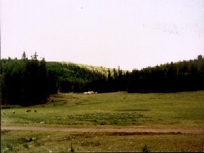
KP Cienega Campground
The actual campground is in the back of the picture, behind the vehicles. The road in the foreground passes around a low, forested hill to the left, then heads to the campground. At the corner is the trailhead for the KP Trail.
KP Cienega is my favorite campground anywhere. Nestled in a tree-surrounded valley, two creeks flow through, exiting together into a valley with an excellent hiking trail. I have been here many times. This time, I spent two days, getting used to sleeping in a sleeping bag and living outdoors again. The only negative note was the extreme lack of rain; KP Creek was bone dry at the higher elevations.
From KP Cienega I traveled north to the high village of Alpine, located at around 9000 feet altitude in the White Mountains. Then I made my way west along gravel roads until I came to the Big Lake Recreation Area, where I spent one night at one of the four campgrounds (all named for species of trout, by the way). The next day I went hiking at Baldy Peak.
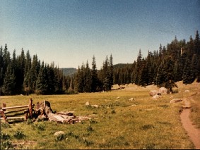
Baldy Peak Trailhead
The fence at the left is the edge of the parking lot. Further to the left, the Little Colorado river comes down from the peaks ahead in the distance. The trail runs along the canyon of the river.
Baldy Peak is the name of the recreation area. The actual peak itself is in the Apache Indian reservation and can only be visited with permission from the tribe. However, it is a long hike, and I have always restricted myself to the lower parts of the trail, where it runs parallel to the Little Colorado river. This is one of my favorite places in the world.
Finally, after spending the day hiking at Baldy Peak, I headed west, through Lakeside and Pinetop, then Show Low, finally stopping at the Colcord Ridge campground in the Tonto National Forest.
The next day I headed west, going out to San Diego to visit my old friend Russ Dearborn.
July 21 - 30: California
Wildernet – California
California Tourism
After spending four days visiting Russ in San Diego, I headed north on the 25th of July, swinging as far wide of the Los Angeles Smog Basin as possible. I ended up on Interstate 5, heading north along the San Joaquin Valley in 100-degree heat. In a non air-conditioned van, that was rather stifling. It was here that I had a rather “interesting” experience. Due to bad judgment, I ended up running out of gas on the freeway. However, just as the engine started coughing and sputtering, I noticed a car pulled over on the shoulder, and pulled over right in front of it. It turned out to be another victim of an empty gas tank—who had already called for a service truck to deliver some. The truck arrived a couple of minutes later, and the serviceman was happy to sell me a couple of gallons, which got me to a gas station. Chance? I prefer to think that the LORD was just being merciful.
Late in the day I arrived at the San Luis Reservoir State Recreation Area, where I coughed up my fifteen bucks and spent the night. Needless to say, I did not use the rain fly on my tent, and I used the lighter of my two sleeping bags.
The next morning I headed out toward the coast and picked up Highway 101 a little south of the Bay Area. As I headed toward San Francisco I once again experienced the temperature drop that comes from approaching the ocean, just like I had during Road Trip '86. Whereas the temps had run over a hundred in the San Joaquin Valley, they were down in the 60's by the time I got to San Fran itself.
The last time I drove across the Golden Gate Bridge the top half had been shrouded in fog. This time it was a clear day. North of the Bay Area I began to really notice one big change that had taken place in the intervening years since my previous trip; the increase in population. Urban sprawl stretched over a considerably wider area than it had back in 1986. It wasn't until I was over halfway up to Eureka that I began to really feel that I had left The City behind.
A very pleasant place to slow down and smell the pine trees is along a stretch of road parallel to 101 called, appropriately, Scenic 101. This byway runs through the Avenue of the Giants, and it is a very appropriate name. Huge redwood trees tower hundreds of feet in the air, many with trunks larger than the length of my van. Although I did not stop there this time, I am definitely planning on a stay at Humboldt Redwoods State Park the next time I pass through this part of the world. (I said the same thing after Road Trip '86, and finally did it during National Parks Tour '04.) There are more than a hundred miles of hiking trails there.
I arrived in Eureka late in the afternoon and filled my stomach before heading inland. As night was falling I came to the same campground in the Six Rivers National Forest that I had stayed at fourteen years earlier. Unfortunately, I cannot recall the name of this campground! It is the only campground on this entire trip that I cannot remember the name of. No doubt, my arrival after dark and quick departure the following morning—on both trips—had something to do with that.
In the morning I left the campground and drove the last few miles to the small town of Willow Creek, where I spent a couple of hours washing clothes at a local laundry. When my clothes were dry I packed up and headed out on State Highway 96, into the hilly, forested land north of Eureka and west of the Interstate. Highway 96 runs alongside the Klamath River, so I was constantly accompanied by the sight and sound of rushing water among the green trees.
Early in the afternoon I arrived in the small town of Happy Camp, situated on the bank of the Klamath River. In the middle of town a bridge runs across the river, leading to a road that winds back into the boonies of the Marble Mountain Wilderness Area. Some 20 miles or so along the road I arrived at the Norcross Campground and Trailhead.
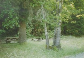
Norcross Campground
(Photo copyright: U.S. Forest Service)
This is a picture of a campsite at the Norcross Campground. This excellent campground nestles in a forested valley at the intersection of two rivers. Two hiking trails are accessible from the grounds.
I spent 4 days at the Norcross Campground, discovering that that period is about as long as I can expect the ice to last in my ice chest. The weather remained excellent, and I enjoyed hikes along two different trails, one of which leads to the Pacific Coast Trail if you go far enough. Both follow the courses of rivers winding through canyons. Along one trail I passed through a burned area and was reminded of the sad effects of forest fires.
After this pleasant interlude I resumed my trek north, back through Happy Camp, and up into Oregon.
July 31 - August 7: Oregon
Wildernet – Oregon
Travel Oregon
Half of my time in Oregon was spent visiting friends, rather than camping. But I began my stay in the southwestern portion of the state in the Siskiyou National Forest. After passing through the Illinois Valley area (the scene of one of the worst fires of the summer of 2002), I stopped in Grant's Pass to pick up food and supplies, then headed out to the coast. After a brief jaunt north on Highway 101 I turned inland along the Elk River, finally coming to the Sunshine Bar Campground, where I spent the next three days.
Sunshine Bar is a pleasant little campground located along the bank of the Elk River at the intersection of two forest roads. The water was icy cold, as I discovered when I decided to take a bath the next morning! However, it appeared that natives of the area are accustomed to it, since a group of young people came out to swim while I was camping. They splashed and played around as if it were ordinary bathwater.
Since there weren't any hiking trails, I basically spent the time relaxing and reading and just enjoying the still wonderful weather. (Though I did wander up the road a little ways a couple of times.) Finally, I packed up and headed back out to Highway 101 and up the coast.
Highway 101 along the Oregon coast is wonderful. By law, the entire seashore from the California border all the way up to Washington is public property, so I did not see any strings of high-rise developments, marinas, etc. Just wild nature. Fortunately, there are a number of publicly maintained “waysides” where a person can park and walk on the beach. This is not a beach you would want to swim at, though, unless you like cold water and air! As I walked from the parking area down to the water's edge, the temperature dropped at least 10 degrees. But I just slipped on a jacket and enjoyed it.
In the afternoon I headed back inland to Interstate 5, then north to Salem, where I turned further inland, passed through the small town of Silverton, then came to the even smaller town of Scott's Mill, where I spent the next five days visiting some friends I used to work with in Brazil. During this time we all went out to Silver Falls State Park and spent an afternoon hiking and seeing the sights.
After my visit I packed up again and continued north, along the back roads, up to Portland, and then into Washington State.
August 8 - 16: Washington
Wildernet – Washington
Experience Washington
I spent a total of nine days camping in Washington, more than in any other state. (I was actually in California for ten days altogether, but four of those days were spent visiting an old housemate in the city instead of camping.) While in Washington I began south of the Olympic Peninsula, heading west along the Columbia River, until I once again rejoined my old friend, Highway 101. From there I passed north, along the coastal marshes and through the two small towns of Aberdeen and Hoquiam, situated on the shores of Gray's Harbor. Beyond these municipalities I drove through the tiny “wide spot in the road” known as Humptulips, then turned east on a back road and made my way to Campbell Tree Grove Campground in the Olympic National Forest.
Campbell Tree Grove is a small campground located deep in an old growth forest, down in the bottom of a steep river gorge. Though a few sites were already taken, several excellent ones remained. I quickly chose one and pitched my tent in a space between trees nearly as big around as the tent itself. Undergrowth was thick and dark green. Because of the narrowness of the gorge and the density of the forest, light-wise this was the gloomiest of all of the campgrounds I stayed at during my entire trip. It gave me a real sense of being in the wild. Mornings usually found the upper part of the gorge shrouded in fog that rolled in from the marine layer. A hiking trail leads through the campground and along the river into the gorge and the wilderness.
After spending three days at Campbell Tree Grove I packed up and bid a sad farewell to a very pleasant place, then drove away. When I got back to 101, I did not head straight to my next camping destination; since from this point on I would be heading east I took a side trip out to the Pacific shore. Again, I was reminded of the fact that the Pacific Northwest coast is a cool climate. And again, I put on a jacket and enjoyed breathing the clean, salt air.
I drove back down through Hoquiam and Aberdeen, then picked up Highway 12 and headed east across the Peninsula. About halfway to Olympia 12 veers south and the main road continues as Highway 8 until once again you reach—you guessed it—Highway 101, this time on its descending stage coming down along the Hood Canal side of the Peninsula. I took 101 into Olympia to pick up supplies, then back out and north along the Hood Canal. When I reached Skokomish Valley Road I turned west, traveled to Forest Service Road 23, then along that road until I reached the entrance to the Oxbow Campground.
It was Friday, and the campground was surprisingly full for a primitive place out in the boonies. There were lots of people from Seattle and the other cities. The campground is situated in the middle of an oxbow (hence the name!), a wide loop in a river enclosing what amounts to a mini-peninsula of land. On the far side from the entrance I found a day use area where people could picnic by the shores, serenaded by rushing water. The opposite riverbank was a steep, water-carved cliff, with a high water mark considerably above the actual surface.
There were no hiking trails per se, but I found plenty of good walking along the river upstream from the campground. The forest was thinner and lighter than on the Pacific side of the Peninsula. The beautiful weather continued, but for the first time I began to be aware of some of the problems that it was causing. Lack of rain was drying things up, and while at the Oxbow Campground I first encountered the “no campfires” restrictions that were to become prevalent the further I traveled.
After three days I left and headed north on 101 along the Hood Canal, then took State Highway 20 east to Port Townsend. I stopped there to pick up supplies, then took the ferry across to Whidbey Island. Highway 20 meandered across this comfortably green isle for a number of miles before finally returning to the mainland. After passing under Interstate 5 (where there was a huge traffic jam!), I continued east into the forest and Cascade Mountains.
While driving through the Cascades I saw snow for the first time in nearly 5 years. Unfortunately, it was at a distance and I never found a place where I could get out and throw snowballs. Maybe next time…
As the day came to a close, I turned south from Highway 20 on Anaeas Valley Road, just east of Tonasket. After several miles I turned onto a forest road, and after a few more miles came to Lyman Lake Campground in the Okanogan National Forest.
I spent three nights at Lyman Lake. Unlike the previous campgrounds, this one was not situated on the bank of a river. Rather, it surrounded most of a small lake. The water was surprisingly warm—at least near the surface. One afternoon while swimming I dove toward the bottom, and was rewarded by numbingly chilly water in the depths. Sunlight doesn't penetrate very deep.
Finally, on the 17th of August I left Lyman Lake, made my way back to Highway 20 (after some rather interesting roundabout driving in the back country), and continued east. That afternoon I left Washington State, passed through the “chimney” of Idaho on U.S. Highway 2 (which was practically one big construction zone!) and arrived in Montana.
August 17 - 21: Montana
Wildernet – Montana
Montana's Official State Website
Western Montana is basically forests and mountains. Glacier National Park lies in this part of the state. Originally, my plans had been to visit this park and then travel north into Canada to see a couple of Canadian parks. However, by the time I arrived in the area, forest fires were raging all over.
It was late in the afternoon when I crossed the state line, and I had practically no information about campgrounds in this state. For some reason, neither Wildernet nor the Forest Service website had yet posted enough useful information to be of much help. (That has, fortunately, since been corrected.) So when I entered Montana I just started looking and praying. And my prayers were answered; before I had gone more than a few miles into Montana, I came to the Yaak River campground in the Kootenai National Forest, where I pulled in and spent the night.
Yaak River was a nice, wooded campground on the shores of, you guessed it, the Yaak River. When I was there it was about half to three-quarters full. This campground is a good place for fishing, although there weren't any hiking trails that I discovered. Of course, I wasn't there long enough to really explore.
The next day I spent a couple of hours in Kalispell, doing necessary things such as having lunch, restocking my larder at the local supermarket, and washing clothes. A moderate sized town, Kalispell nonetheless has a small town feel. I liked it. It lies a bit north of Flathead Lake, which was where I spent the night at Yellow Bay State Park.
By now I had gotten my hands on some local campground information, and wanting to save a few bucks I looked for and found another freebie in the Gallatin National Forest over by Bozeman, a little place called Battle Ridge. I spent three nights there, intending to leave on the 22nd and go down to Yellowstone Park.
While at Battle Ridge I had an interesting experience. A young woman drove in, hauling a U-Haul trailer behind her truck. She was moving from Minnesota to Seattle, WA, and had all of her worldly goods with her. We talked a bit, then when she got back into her truck to pull up to a campsite, the trailer hitch knob fell off (“Lock-washer? We don't need no steenking lock-washer!”) and the trailer ground its nose into the gravel road. From the sound I thought that the whole thing had fallen apart! Fortunately, she had been off to the side of the road a bit and did not end up blocking the way. She stayed the night at a neighboring site, then went into town the next day (minus the trailer!) and got a new knob (with a lock-washer). When she returned we put it together, then spent the next hour unloading the trailer, hooking it back to the truck, then reloading. Then she continued on her voyage.
The next day, while I was relaxing around the campsite, a couple of Forest Service workers came in and posted notices on all of the bathroom doors, as well as the big poster board at the campground entrance. One of them asked me how long I was planning to stay. I told him I was leaving the next morning. His reply: “Good! We're closing the forest tomorrow night.”
The forest fires were definitely getting serious.
August 22 - 26: Wyoming
Wildernet – Wyoming
State of Wyoming
I entered Wyoming through Yellowstone National Park. This was the second time I had been in the park, the first time being fourteen years earlier on Road Trip '86. That time I passed quickly through, visiting only a few attractions. This time, I camped in the park near the south entrance at Lewis Lake. Since I arrived in the middle of the day I had lunch, then went out to travel around the south loop, seeing the geysers and other sights of interest. I spent the entire next day seeing as much as I could before moving on. I have to admit that two days merely whetted my appetite. I still intend to return for a stay of more like a week.
I left Yellowstone and went on to Grand Teton National Park, which is directly connected to Yellowstone by means of the John D. Rockefeller Jr. Memorial Parkway. Unlike the last time, this time I did not spend the night in the park. Instead, I merely stopped at Jenny Lake for a few hours to hike one of the many trails. Again, I intend to return again for a couple of days and head up the Cascade Canyon trail for a real hiking experience.
After I left the national parks I drove into the Bridger-Teton National Forest and spent three nights at the Boulder Lake campground. This is a small campground at the end of a very bumpy road. The surrounding countryside is largely open plain, but the campground is situated on the edge of Boulder Lake and is in the trees. A trailhead leads into the forest, splitting into two separate trails. Unfortunately, these trails were closed while I was there because of fires.
August 27 - September 3: Colorado
Wildernet – Colorado
The Official Site of Colorado Tourism
I learned that northern Colorado is different than southern. In the north there is much more high plain, whereas in the south there is more forest. Nevertheless, I found a small, out-of-the-way campground to spend my first night in the state, a little place called Crosho Lake in the Routt National Forest. Even so, the place was practically filled; I hadn't realized that it was hunting season in Colorado!
Crosho Lake
(Photo copyright: Zander Higbie – Interactive Outdoors)
The campground itself is actually behind the person taking the picture. The sky is just about exactly the way it was while I was there.
The next day I made my way over to the White River National Forest and found a campground on the shores of Green Mountain Reservoir, a place called Elliot Creek. As campgrounds go I didn't find it that impressive. The biggest thing of note was the return of rain! After spending a month and a half practically without a drop, the onslaught of heavy thunderstorms was a drastic change. And they were pretty heavy. The second morning a dog showed up at the campground that had run away from her home in fright because of all the thunder and lightning. Her owners showed up in the middle of the morning to take her home.

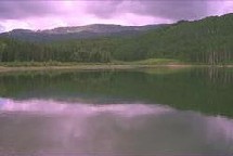
Campsite at Elliot Creek
(Photo copyright: Zander Higbie – Interactive Outdoors)
The body of water in the background is Green Mountain Reservoir. While I was there I never saw the sky so blue!
After three days at Elliot Creek I packed up everything and drove over the mountains, through the Eisenhower Tunnel, and came to the Denver area, where I spent the next four days visiting friends.
September 4 - 5: South Dakota
Wildernet – South Dakota
Travel South Dakota
I left my friends' home on Labor Day. That wasn't a problem until late in the afternoon when I pulled up at a stop light and discovered that I only had 3rd and 4th gears working in my car! Fortunately, I was able to quickly find out what was wrong myself and effect repairs—using baling wire. My fix was still holding a couple of weeks later when I returned the vehicle to my sister and brother-in-law.
I quickly discovered that the campgrounds I had researched on the Internet were closed. You guessed it: fire. Fortunately, the Black Hills National Forest has plenty of campgrounds, and I found one called Oreville that was open for business, so I ended up spending the night there. Oreville is a very “civilized” campground, with mown grass, flush toilets and paved roads. A nice spot to base out of if you are visiting the area. However, I was just passing through.
The next day I drove up to Rapid City and picked up the Interstate (after sitting for fifteen minutes in view of the freeway, waiting for a train to pass!). Driving east, I passed near Badlands National Park. So, naturally, I took a detour to see this attraction.
The parks I had visited before had all been lush and green and cool. Badlands was different. Basically, it is a gigantic drainage ditch from some tremendous runoff back some time in history from the Black Hills. The water carved formations are fascinating. There are plenty of trails and much to see. Someday I hope to return and see a bit more, but this time I only stopped for a couple of hours. It was enough to see some of the sights and to drive the main road through the park. (Though I did return during National Parks Tour '04 and Combination trip 2010.)
Late that afternoon, I came to Walkers Point State Recreation Area, where I found a campsite and spent the night.
September 6: Minnesota
Wildernet – Minnesota
Explore Minnesota
By this time I was racing to get up to the border and drive across the north shore of Lake Superior, so I went through Minnesota basically without stopping for anything except lunch and to camp at night. It was late afternoon when I passed Duluth heading along the lake shore, and I was closer to the Canadian border than Duluth when I came to Cascade River State Park and found a site to spend the night. It was already raining when I got there, so I didn't bother to pitch my tent. This was one of the times when I was glad I had a cargo van; I just rearranged a few things inside, rolled out my sleeping bag, and hit the sack.
September 7 - 9: Ontario
The Official Website of Ontario Tourism
It was a rainy morning when I set out to cross the border. After a thorough search at the Customs station to make sure I wasn't carrying nuclear weapons, I was allowed to enter. (This was one time when I was glad that my sister had given me a notarized letter authorizing me to use her van; the fact that my driver's license was from Texas and I was driving a Wisconsin vehicle raised a few eyebrows.)
I stopped in Thunder Bay to stock up and exchange money. Afterward, I just spent the day driving. I was glad that the weather was cool and wet; the car didn't get hot and I was quite comfortable. The lake to the right and forest all around provided a very pleasant backdrop. I stopped at a small town for lunch, but other than that just kept going.
Late in the afternoon I came to Lake Superior Provincial Park, located on the eastern shore. I chose the southernmost campground, a place called Agawa Bay. The first night, of course, was still wet and drizzly. However, the second day was absolutely perfect! The wind died down, the sky cleared, and the temps reached around 70. A great day for walking along the shore and exploring the area. The weather on the last day wasn't quite as nice, but was still very acceptable. Finally, after three days I packed up and headed back to the U.S. of A.
September 10-11: Wisconsin
Wildernet – Wisconsin
Travel Wisconsin
I crossed the border back into the States at Sault Ste. Marie, entering the Upper Peninsula of Michigan. From there I drove west until I came to U.S. Highway 45, where I turned south, crossed into Wisconsin, and came at last to Eagle River, the town I grew up in.
I hadn't been back in Eagle River for several years, and it was interesting to note the changes. After finding a campground at Anvil Lake in the Nicolet National Forest, I drove back into town to visit my old haunts.
The only bad thing was the huge amount of road construction taking place on the western side of town. Some of the local businessmen complained that it had hurt the tourist industry that summer. But looking at it I could see that when it was completed it would greatly help traffic flow. So I avoided that part of town (except to eat at the Pizza Hut, which did not exist when I was growing up there!), and wandered about. I did not run into anyone I knew, but I did encounter some people related to them. Homecoming? In a way. On the other hand, I've been gone for so long that it isn't really home any more.
After two days I packed up everything, headed south on 45 to Highway 29, then went east to the Angelica-Pulaski exit where my sister and brother-in-law live just off of the four-lane road.
All good things must come to an end.