Overview
This was a trip that almost did not happen.
Actually, this was not my originally planned trip for this year. If things had gone as planned, I would have gone to Indiana, then Wisconsin, and finished with a tour around the West reminiscent of National Parks Tour '04, with the additional benefit of visiting friends in Washington and California. But the best-laid plans of mice and men often fail to take into account the whims of politicians taking advantage of a crisis. I won't go into detail here about how the response to the Chinese virus was wrong on so many levels, except to say that the country would have been far better served by listening to medical professionals, rather than government bureaucrats.
Anyway, instead of leaving for Indiana in early May, I wound up staying in Tucson during the blast-furnace month of June. I managed a brief getaway to Mt. Graham for a few days (I was originally planning to go to Mt. Lemmon, but a lightning strike burned down nearly the entire forest up there). After that, the only thing I could do was keep checking the status of National Parks and National Forests on-line.
In the latter part of June, I discovered that while Parks such as Yellowstone and Glacier were refusing to return to any semblance of normal operations, Grand Teton Park was essentially open for business. A definite step in the right direction!
The next issue was getting there. Earlier, while many Forests across the West were returning to normal operation, the Apache-Sitgreaves Forest was not. This was a problem, because I needed a place to camp on my way north. I checked out the Tonto National Forest, and they were open at first. However, dry conditions and a major fire forced them to close their campgrounds.
Fortunately, by late June, even Apache-Sitgreaves began to return to normal. Most campgrounds opened up. I began checking Forests in Colorado and Wyoming for more details. (I had originally checked Forests in Montana as well, but when Glacier dug in their heels and refused to open campgrounds, I abandoned plans to visit that state.) So I began to plan what eventually became this trip: Grand Teton Trip 2020.
Compared with most of my camping trips, it was relatively short, lasting six weeks. And whereas I usually visit ten states or more, this time I ended up with only three. But while it was short on quantity, I like to think that it had plenty of quality. I was well-prepared both mentally and physically. I planned well, including contingency options. Since I am now over 62, I was able to get a Senior Pass, which in addition to covering the cost of entry into National Parks, also gives me a fifty-percent discount on camping.
And I got a screen house to take on this trip.
In the past, I always took my tent and sleeping bag, plus cooking equipment and other basic necessities. I also took a tarp that I would string up over the campground picnic table to protect it from rain and provide some shade. The tarp was often difficult to set up. It relied on having trees in the right locations to tie ropes to. I had to arrange for rainwater to run off and not accumulate on top, where the weight could break the ropes or even rip the tarp. And it did not keep mosquitoes and flies out.
So as I said, this year I bought a screen house. With a waterproof top and side screens, it provided protection from sun, rain and bugs. It came with its own poles and guy ropes and did not depend on strategically-located trees in order to set up. Overall, I found it very useful, and definitely better than a tarp.
I left on the Tuesday following the Fourth of July. And I was gone for six weeks, returning to Tucson on the 18th of August. I stayed at ten different campgrounds, four of them twice. Unlike most of my trips, this one was out-and-back: Tucson to Grand Teton Park and back to Tucson. But as always, I was not in a hurry. I spent many enjoyable days camping, met some good people (and their dogs!)—and even learned some things about myself that God wants me to work on improving.
So without any further ado, I now present Grand Teton Trip 2020.
July 7: Arizona
Wildernet – Arizona
Arizona Highways
I left Tucson fairly early in the morning, knowing that the trip to my first destination would take around five hours—assuming no serious delays from road construction. It was a nice drive, without a lot of traffic, on secondary roads all the way up to Show Low. At that point, the traffic grew heavier as I passed through the tourist town of Pinetop-Lakeside. At the time, I did not know what to expect when I arrived at the campground. Some sources indicated that outdoor activity was way up this year, because places like Disneyland were closed and overseas travel was restricted. Others indicated that fewer people than usual were out enjoying nature. So I began this journey with a lot of uncertainty.
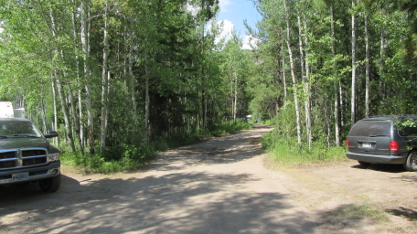
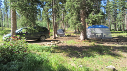
The high volume of traffic—including a lot of camping trailers—concerned me. Would I find a site available? Or would the campground already be full, even on a Tuesday? Fortunately, as I got away from Pinetop-Lakeside, the traffic diminished a lot, and by the time I turned off on State Highway 273, it was pretty light. And when I arrived at Winn Campground, I was pleased to discover that, while there were quite a few other campers, there were also a number of non-reservable sites still available. Thus began my first night.
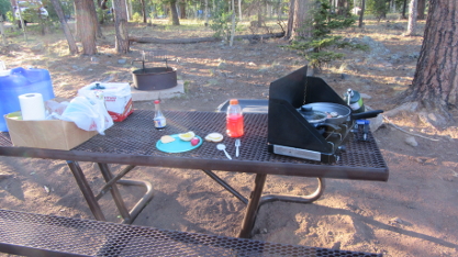
Preparing Supper at Winn Campground
I had a destination further north in mind for my first weekend on the road, so I only stayed one night at Winn. I did not even bother setting up the screen house. The next morning I hit the road for Colorado.
July 8 - 15: Colorado
Wildernet – Colorado
The Official Site of Colorado Tourism
After passing through New Mexico, I arrived in southern Colorado. My first goal was a campground that I had never stayed at before, called Target Tree, in the San Juan National Forest. Again, I was uncertain as to whether or not I would be able to find a site. The campground is listed as having light usage, but it is also located directly off US Highway 160. Again, I was pleased—and admittedly relieved as well—to find quite a few sites still available.
Site at Target Tree Campground on First Visit
Once again, I did not put up the screen house, since I was only planning to stay one night. One nice thing that I quickly discovered was that there was a strong cell-phone signal at the campground. It was nice to be able to update people on my progress via text messages and WhatsApp. And using my phone as a wi-fi hotspot, I was able to catch up on email.
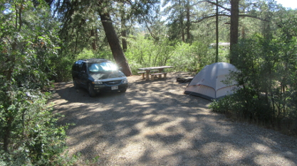
The following morning I left and drove a considerably shorter distance to get to Cathedral Campground, in the Rio Grande National Forest. I had stayed here previously, during Rocky Mountain High '05, Combination Trip 2010, and Spiritual Journey 2015, so it was an old favorite that I knew quite well. Given my experience the first two nights, plus the fact that Cathedral is located more than twenty miles off the main highway on a dirt road, I was a lot more confident of finding a site there. And as it turned out, there were plenty of sites available.

Rear View of Campsite at Cathedral with Screen House
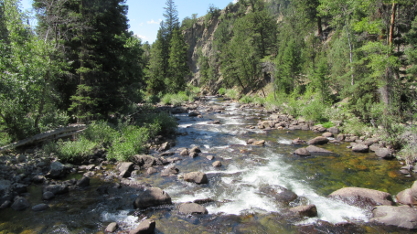
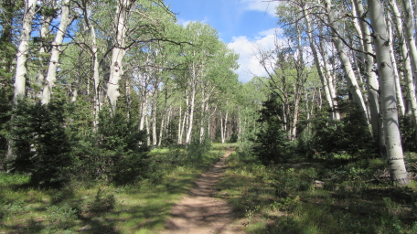
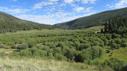
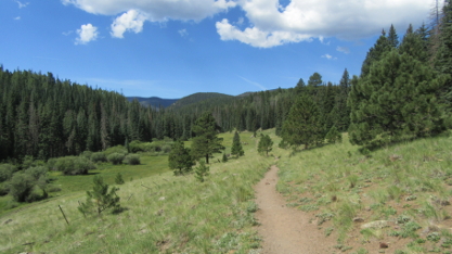
I stayed at Cathedral for the weekend. During the entire time, it never even got half full. This was a bit unusual; I had been here before on weekends and it always got a lot fuller. But I did not complain! Days were pleasant and nights comfortable for sleeping. And on Saturday, I went and hiked a ways up the Embargo Creek Trail, near the campground.
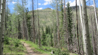
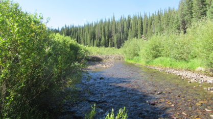
View across Embargo Creek Valley from Trail
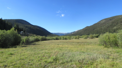
I left Cathedral on Monday. After a quick stop in Del Norte for groceries, I headed up to the San Isabel National Forest, where I turned off Highway 24 just short of Leadville to head for Halfmoon East Campground.
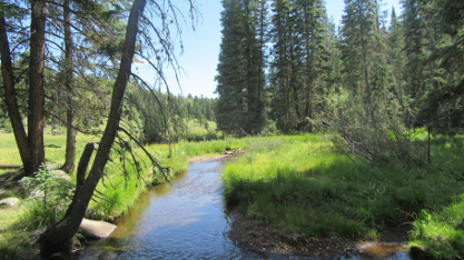
Halfmoon East is a small campground. It is just around the corner from its companion campground, Halfmoon West, which is larger, but across the road from Halfmoon Creek. Halfmoon East is on the Creek, which was a real blessing. The campground host later on commented that I was lucky to have found that the site where I stayed was still available. Maybe, but I like to think that it was also an answer to prayer.
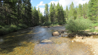
Halfmoon Creek behind Campsite
I stayed there for three days. On Wednesday, I took a short trip into Leadville to do laundry, get a shower (first one in eight days!), fill the gas tank, and do some grocery shopping. Therefore, when I left on Thursday morning I did not need to stop anywhere. I was able to drive straight through to my next destination in Wyoming.
July 16 - August 5: Wyoming
Wildernet – Wyoming
State of Wyoming
This was not the first time I stayed at Lost Creek Campground in the Medicine Bow National Forest. I went there for the first time during Rocky Mountain High '05, and after that returned during every trip.
This medium-use campground lies just off State Highway 70. During Spiritual Journey 2015, I only stayed one night, but I liked the site, and this year I decided that I wanted to stay at it again. So I prayed as I drove. When I arrived in the early afternoon, the site was available—but when I looked at the site next to it, which was also available, I decided that I liked it even better. So that was where I ended up staying. I also solved the mystery of the campground water supply; the campground is listed on-line as having water, but ever since the spigot that was in use during my first stay was closed down, I had assumed that they simply had not updated their site. Turns out it had simply been moved—to the site where I ended up staying!
Lost Creek Campground looking West near Entrance
I stayed for four days. While I was there, I went across the highway to the trailhead over there and hiked a ways down the Baby Lake Trail. There was another trail which went into the Huston Park Wilderness, but I decided to leave that for when I returned on my journey home.
View of Mountains on Baby Lake Trail
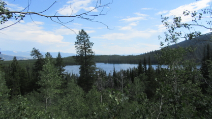
I left Lost Creek on Monday to continue my journey. On the way, I stopped at Walmart in Rock Springs, and I was very disappointed. I could not find half of what I was looking for. They were busy rearranging the layout in a manner quite different from every other Walmart that I visited, and that definitely did not help. Anyway, after getting what I could, I continued north on US 191 until I reached the turnoff for the Boulder Lake Recreation Area, in the Bridger-Teton National Forest.
Again, this was an old friend. I first stayed there twenty years earlier, during Camping Trip 2000, then returned during Spiritual Journey 2015. After two and a half miles of paved state highway, the road to the Recreation Area is ten miles of gravel. In 2000 it was a dreadful washboard. In 2015 it was in excellent condition. This year it was still in good condition. The Campground lies on the north side of the Recreation Area.
When I arrived, I found several sites still available. Unfortunately, none of them had a good place to pitch a tent, and so I ended up sleeping in the van. I also discovered that there is a phone signal there, but it is not as good as the one at Target Tree down in Colorado. I was sporadically able to use my phone as a hotspot and download email, as well as send and receive text and WhatsApp.
View of Boulder Lake Recreation Area
As I discovered in 2000, there is a trailhead that leads to a couple of trails. During this stay, I hiked up to the top of the canyon on the Blueberry Lake Trail. I had to do a lot of climbing, rather steep in places, but the view was definitely worth it!
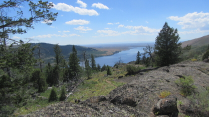
Boulder Lake from Blueberry Lake Trail near Top of Canyon
On Thursday, I left bright and early in the morning, just after 7:00, heading for Grand Teton National Park.
Earlier on the trip, I had found campgrounds to be emptier than usual. At Boulder Lake, that began to change. But it was only when I arrived at the Park—around 9:30 in the morning—that I discovered the magnitude of the change. As I mentioned in the Overview, many Parks had refused to return to any semblance of normal. So since Grand Teton Park was bucking the trend, it appeared that everyone from all over the country was going there. And after two hours of running around the Park, only to find that each campground had filled up before I arrived, I was forced to realize that I would not be able to find a place to stay—and so I ended up leaving.
This was obviously not what I either planned or wanted. Because my clothes were all dirty, I stopped in Jackson at a laundromat to wash them. While I was there I did some thinking. I remembered that there were three campgrounds not very far from Jackson. Two of them were right on US 191. One of them, Hoback, was listed as heavy usage. The other, called Kozy, was only light to medium use.
I decided that it would be worth my effort to at least try to get into one of these two campgrounds. After all, what did I have to lose? So I made the decision to at least try. If I found a site at either one, then I would stay the weekend and try returning to the Tetons even earlier on Monday. If not… If not, then I would start heading home to Arizona.
So after finishing my laundry, I headed south out of Jackson, then east on US 191 at Hoback Junction. Eight miles later I arrived at Hoback Campground. I was not terribly impressed with the place—although I would have stayed there anyway if any sites had been available. None were, so I continued on my way. Kozy Campground was only five miles further… and when I got there I found three or four sites still available. Praise the LORD!
After a slight mix-up with site numbers, I ended up in Number 6. Kozy is a very pleasant little campground, right on the bank of the Hoback River. There were no hiking trails in the area; the main attraction for visitors is fishing. Since I did not have either a license or a pole, I did not bother. I basically relaxed, knowing that if I got into Grand Teton Park on Monday, I would get plenty of hiking exercise there.
View of Valley and Hoback River by Kozy Campground
While I was at Kozy, I met some of my neighbors and had a nice time visiting with them. The weather was pleasant; mild days and cool nights. During my time I sensed God reminding me that I have the habit of jumping to negative conclusions way too quickly. I've been that way all my life. Maybe He was trying to tell me that this is something that I need to work on in my life. At any rate, it was a relaxing stay, a nice prelude to a visit to the Tetons.
So on Sunday afternoon I put away my screen house and tent and got my car packed up, then slept in the van that night. And on Monday morning, I drove out of the campground just after 6:00, ready for my second try to get a place to stay in Grand Teton Park.
After getting through the road construction south of Jackson—and the city itself—I found myself in line at Gros Ventre Campground just after 7:00. To give you an idea of how busy the place was, I was already around the 30th car in line. Fortunately, they were expecting 60 vacancies that morning, so all I had to do was wait my turn. Finally, at around a quarter to nine, I got a site. Hallelujah!
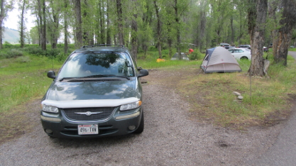
Car and Campsite at Gros Ventre Campground
In National Parks, a campground is merely a place to sleep at night. So after pitching my tent (I did not bother with the screen house), I left to see the Park. However, before I began hiking and sightseeing, I really needed a shower. I had gone 12 days without one! Sure, I'd managed to wash my hair from time to time, but overall, I felt quite scungy. So I made my way up to Colter Bay, where they had many facilities, including showers. After a shower—and feeling much cleaner!—I got a few supplies at the store next door, then had a picnic lunch at one of the tables next to the store. With all that done, I chose my first destination in the Park to visit.
Before getting to my first hiking destination, I drove past the Jackson Lake Dam. While there, I decided to stop briefly and take a few pictures. Here is one of them:
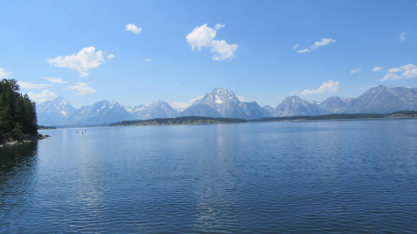
View of Jackson Lake from Dam
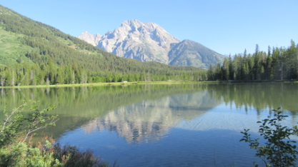
I'd been to Grand Teton Park a few times before. I'd even stayed overnight a couple of times at Jenny Lake Campground. But I had never been to Taggart Lake. Truth is, I'd never even heard of it. But since I was doing a serious visit this time, I checked the literature more closely, and decided to do the Taggart Lake - Bradley Lake Loop Trail.
Once again, I was impressed with the number of visitors when I arrived at the parking lot. Cars overflowed out onto the road, parked alongside for a couple of hundred feet in either direction from the entrance. I figured that I'd probably have to do the same. But when I drove into the parking lot, at that moment I saw someone pulling out of a slot right in front of me. So I quickly pulled in to that brief vacancy.
It was an enjoyable hike. The trail crossed some open meadows near the beginning, then began to climb, passing through forest and more open areas. At the fork I went left, which took me up to Taggart Lake itself. From there, the trail continued on to Bradley Lake. Here are a few pictures:
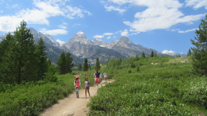
View of Mountains from Open Area on Trail
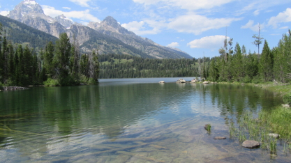
Taggart Lake from Bridge at South End
Taggart Lake from Trail to Bradley Lake
Bradley Lake from Shore
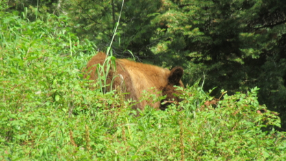
After leaving Bradley Lake, I climbed up over the ridge and started down toward the trail junction. I had only gone a short distance when I suddenly met a couple of “friends”. Here they are:
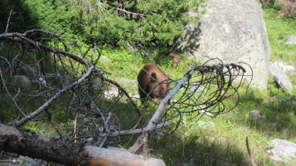
Mama Bear and Cub by Trail
I first became aware of their presence when three gals about a hundred feet in front of me on the trail, coming my way, started shouting, “There's a bear on your left!” So I turned and whoa! Yes, there was a bear on my left. Two bears, in fact; a mama and her cub. After taking that picture (using the camera's zoom feature), I walked past, not looking at them, and talking loudly. The gals said that the bears were moving away. Afterward, they wanted a copy of my picture so much that one of them gave me her WhatsApp number so that I could send it!
After saying good-bye to Mama and Boo-Boo, the rest of the hike was uneventful. I went back to my campsite, had supper, and went to bed. End of first day.
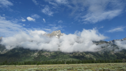
Tuesday dawned nice—but even before I finished breakfast, the clouds were rolling in. It looked like the string of nice, dry days was about to come to an end. And sure enough, by the time I was driving out of the campground, the rain was already coming down.
All morning, it came and went. I drove down to Jackson to pick up a few things at the supermarket that I could not find at the stores in the Park. I found a place with a decent phone signal and caught up with email. I finished a Prayer & Praise Update. I took a few pictures of the Tetons surrounded by clouds. Here is one of them.
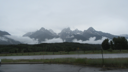
Tetons with Clouds along Bottom
After lunch, however, things were beginning to look better. The rain had dropped to light sprinkles, and blue sky was starting to appear in places. Going through the visitor material, I decided to hike up to Phelps Lake.
The Phelps Lake Loop Trail begins in the Laurance S. Rockefeller Preserve. There is limited parking, and I was more than a little concerned when I got on the road and found myself in the midst of a long train of vehicles. Fortunately, as we approached the entrance to the LSR Preserve, most of the cars continued past. Only one other driver turned off. So there were two of us heading for the parking lot. When we passed the exit I glanced in and saw at least two empty slots, so I realized that unless there were more visitors ahead and out of sight, waiting for their turns to get in, then there should not be a problem. There wasn't. Turned out that there were several more vacancies as well, and I soon was parked and ready to hit the trail.
Just like the Taggart Lake trail, this trail also split part way up. Again, I took the left fork and followed it up to the lake. The sprinkles had stopped, but by now the mountains were totally wrapped in clouds. Here is my first view of Phelps Lake as I approached:
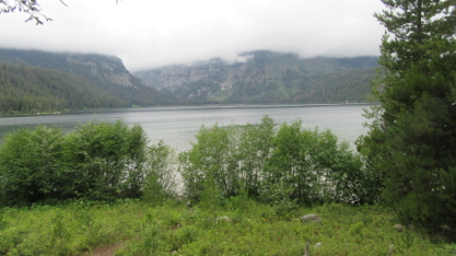
Approaching Phelps Lake with Tetons Behind
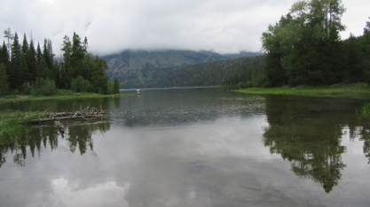
I followed the shore up to the north end of the lake, where the Woodland Trail headed off into the forest to loop back to the trail division. Here is my final picture of Phelps Lake as I was leaving:
Phelps Lake from North End
As I was leaving, I ran into a couple who mentioned that there was a bear further on the trail around the lake. I thought about going to see, but since I'd already seen a bear the day before, I decided that it would not be worth it. So I continued on the Woodland Trail, back to the division, and then back to the parking lot.
It was a cold evening back at the campground. It had never really gotten very warm that day, and the wind was rather brisk. But I relaxed and did some reading after supper, and when I crawled into the tent it was quite comfortable. End of second day.
Wednesday dawned partly cloudy, but it was already clearing up by the time I finished breakfast. Before leaving the campground, I went and checked out the Gros Ventre River, which lies in back of it. Of course, I took a few pictures. Here is one of them (along with my shadow!):
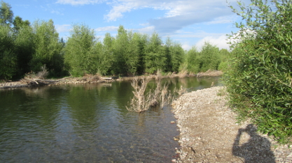
View Downstream of Gros Ventre River
Today, I first decided to hike a trail out to Two Ocean Lake, in the northern part of the Park. Unfortunately, I was unable to find the trailhead. It was clearly marked on the Park map, but even though I drove back and forth past where it should have been, it was not there. I did see a place with construction equipment that might have been the trailhead parking. But even though I stopped and asked at a convenience store, nobody had a clue.
So I headed south, looking for other options. On the way, I noticed clouds hanging low in front of the Tetons and thought that it would make a good picture. Here it is:
View of Tetons in Morning Light with Clouds in Front
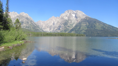
In the end, I decided to visit an old friend, Bearpaw Lake. To get there, I needed to start at the String Lake trailhead, which is on the Jenny Lake Loop Road. However, when I got there I discovered that not only was the main parking lot full, but all of the overflow parking lots were also full. A bit discouraged, I looked for alternatives, and finally decided to go to Lupine Meadows and take the trail there up to the north side of Bradley Lake (my previous hike to Bradley Lake on Monday only went to the south side).
Lupine Meadows lies on a gravel road that turns off of the main road just south of the Jenny Lake Loop Road. Once again, as I drove toward the trailhead parking lot, I passed through overflow lot after overflow lot—all of them chock full. When I got to the main lot, right next to the trailhead, I expected it to also be full, and that once again I would be forced to look for another activity. But when I got there, lo and behold! There was an empty space right across from the outhouse! I then remembered seeing at least one car coming out while I was driving in, and realized that someone had just vacated the space. So I quickly pulled in and took it. Praise the LORD!
There was one trailhead, but partway up the trail it divided, with one branch going up to Amphitheater Lake, and the other going over to Bradley Lake. As I mentioned earlier, I planned to go up to Bradley Lake again. While on the first part of the trail, I ran into someone that I recognized. Here she is:
Bear eating Berries by Trail
No, I was not really that close. Again, I used my camera's zoom feature. And you can just barely see a cub a bit to the right and behind. Since this was less than two miles from where I'd seen a brown bear and cub on Monday, it is very possible that this was indeed the same bear! But I can't be sure.
Here are a couple of views of Bradley Lake:
Bradley Lake in Distance from Descending Trail
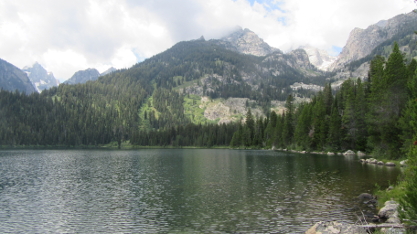
Bradley Lake with Tetons Behind
I had taken lunch fixings with me in my backpack, so when I got up to Bradley Lake I sat by the shore and had a picnic lunch. It was actually rather late, after 2:00, and I was quite hungry by then. Afterward, I headed back down the trail. When I got to the parking lot, I found that it was still full, and just as I approached my car, another car drove up looking for a spot. Remembering the blessing that I had received when I got there, I told them that if they'd wait a few minutes, they could have my spot. They were happy to get it!
With another good hike under my belt, I returned to the campground for supper. I was already making plans to return to the String Lake trailhead on the following day—first thing in the morning. End of third day.
Thursday dawned mostly clear, and after breakfast I headed out for the String Lake trailhead. I did not plan to spend the entire day hiking and sightseeing; I would be leaving the following morning, and before I left I wanted to wash clothes and get a shower. So in addition to needing to get to the trailhead parking before it filled up, I also wanted to get an early start so that I would have time to do those things.
I arrived around 8:30, and there were still plenty of parking spots available. I got a space in the second row and quickly got underway. In addition to hiking along String Lake, I also planned to continue past and go to Bearpaw Lake. I had been to Bearpaw Lake during Rocky Mountain High '05, and this year I wanted to return.
Tetons behind String Lake near North End
The trail to Bearpaw Lake began at the north end of String Lake. First, it went along the eastern shore of Leigh Lake, which offered some more excellent views. North of Leigh Lake, the trail divided, with one trail going along the east side of Bearpaw Lake and the other along the west. I had already been to the east side, so I took the trail to the west side this time.
View Southwest of Leigh Lake and Tetons
View Northeast of Bearpaw Lake from West Side
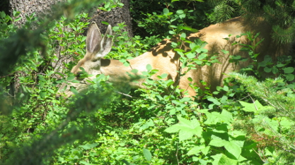
Another New Friend by Bearpaw Lake—but Not a Bear!
By the time I got to Bearpaw Lake, I realized that the trail was quite a bit longer than I had anticipated. It was already almost noon. I would have liked to go visit the east side of the lake on my way back, but as I mentioned, I'd already been there, so I decided that it was more important to get back to the car and get going. Also, since I had not realized how long it would be, I did not have any lunch with me. By the time I got back to the parking lot, it was nearly 2:30, and I was hungry!
I got my shower. I washed my clothes. While my clothes were washing, I got on to the public wi-fi and caught up on email. Afterward, I drove down to Jackson and stocked up at the supermarket and filled the gas tank. Then I drove back to my campsite and had supper. End of final day.
In spite of the large crowds, it was a good time. I got to see places in the Park that I had not seen before. I got plenty of exercise (to help avoid extra size). I gave thanks to the LORD that I had been able to get a place to stay at a campground, even though I originally had to go away and come back on Monday. Now it was over. Now it was time to start back to Tucson.
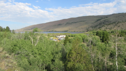
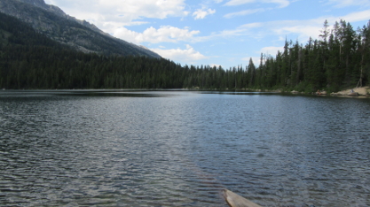
Friday morning, I headed out. I only stopped in Jackson long enough to get ice, then I was on my way. I was heading back to Boulder Lake to spend the weekend. While usage is normally light there, my previous experience indicated that it was a bit heavier this year, so I wanted to get there early. I did. And there were only 3-4 sites still available. I was able to get one that was decently wooded, even though it still did not serve for pitching a tent. I had to do a trick with the screen house to get it up, since this campground has lantern poles attached to all picnic tables. But it was a place to stay for the weekend.
View of Boulder Lake Campground by Site during Return Trip
In addition, I took a hike up the Boulder Canyon Trail on Sunday. After resting up from four straight days of hiking in the Tetons, I was ready to hit the trail again.
View of Boulder Creek from Footbridge on Boulder Canyon Trail
On Monday, I left Boulder Lake and headed south and then east. I was heading back to Lost Lake, and I figured that being Monday, there would probably be plenty of sites available. Unlike up near the Tetons, this campground had not been unusually full on my previous visit. When I got there, I found only one site occupied. Unfortunately, it was the one site that I wanted! But the site next door proved to be a good one, too. So I put up the tent and screen house and settled in for a three-day stay.
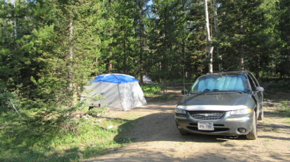
Campsite during Second Stay at Lost Creek
Again, while at the campground I decided to do a hike. Across the highway, at the same trailhead as the Baby Lake trail, another trail went into the Huston Park Wilderness. This one is wide and suitable for four-wheeling, but I did not encounter anyone riding on it. Nor did I encounter a bear, which I did when I was there in 2010. (That bear was much further away than the ones I saw up in the Tetons!)
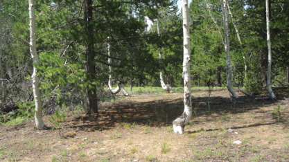
Aspen Trees with Twisty Bottoms in Huston Park Wilderness
On Thursday morning, after nearly three weeks in Wyoming, I finally left the state and headed down back into Colorado.
August 6 - 14: Colorado
Wildernet – Colorado
The Official Site of Colorado Tourism
When I planned this leg of the trip, I intended to go to Yeoman Park Campground in the White River National Forest. I first camped there during Combination Trip 2010, and returned while on Spiritual Journey 2015. Unfortunately, after passing through the town of Eagle on my way to the campground, I found out that the road up the mountain had been closed due to construction—the day before my arrival. Arrgh!
Fortunately, I had printed and bound a list of campgrounds before starting this trip. This is something that I do every time, and more than once it has saved the day. So I stopped and consulted it. I remembered adding a new campground, not far from the city of Montrose, to the list, shortly before taking off. Called Iron Springs, it is in the Uncompahgre National Forest, on the plateau southwest of the city. The usage was listed as light. It took a few hours to make the drive—including sitting stalled on the freeway because of more road construction—but I eventually made my way to Montrose, found State Hwy 90, and made my way up to the campground. When I got there, I was happy to see that three of the seven sites were still available. The other four were occupied by members of a dirt bike club who were out there trail-riding. They were a friendly bunch and invited me to join them around their campfire in the evening. We exchanged bear stories.
View of Campsite at Iron Springs Campground
One of the uncertainties this year had been whether or not I would find a site available when I got to a campground. Now some campgrounds offer sites that can be reserved on-line, and that included the final two campgrounds where I planned to stay on this leg of the trip. So on Friday, I made my way back down to Montrose—leaving my campsite set up, of course—and did some jobs that needed doing, such as buy food, wash clothes, and get a shower. While my clothes were in the machine, I got on-line and reserved a site at both of my final campgrounds. As a result, I only needed to find a site at my next stop. After that, everything was set for the rest of the trip.
While I was at Iron Springs, I discovered a connection trail that led to the Hornet Spur Trail. So on Sunday I decided to take a little hike, and followed this trail for a ways through the forest. Nothing strenuous or long; just a nice, pleasant walk in the woods.
Passing through an Aspen Grove on the Hornet Trail
On Monday morning I left this excellent campground to continue my trip.
My next destination was also in the Uncompahgre National Forest. I first went to Big Blue Campground back in 2005, and returned ten years later in 2015. Both times I stayed in the same site, where the road curves around to go to the sites behind the spur that the campground is on. When I arrived this year, I was happy to find that not only was that site still available, but so were four or five more. So I set up my tent and screen house at the old familiar place.
I spent three days at Big Blue. While there are some trails in the area, most of them require getting your feet wet in order to cross creeks. Besides, this time I simply wanted to relax. I did wander up and down the road near the campground—it is set along the side of a green, tree-lined valley—just to stretch my legs and to take some pictures. Here are a few of the pictures I took:
View down Big Blue Valley from Hill near Campground
View up Big Blue Valley from Beginning of Failes Creek Trail
Big Blue Valley from Fishing Spot on Big Blue Creek
On Thursday, I packed up the tent—I'd packed up the screen house the day before, after my last major meal—and left Big Blue. Before I left, I decided that I would try one of the other sites the next time I go there. I like the one where I stayed, yet there is one on the back side that I think I would like even better. Well, that's in the future, whatever the future brings.
After I left, I made a quick stop in Lake City to get a shower. Then I made my way down State Hwy 149, also known as the Silver Thread Byway, back to US Hwy 160. After a quick stop in South Fork for groceries, I made my way back to Target Tree Campground, which had been my second stop on the outbound leg.
This time I stayed two nights. I also discovered the benefit of reserving a campsite, since all I had to do was show up, find my site, and set up. The campground host came by a little while later, but it was just to welcome me and wish me a pleasant stay. Just like the previous time, there was a very good cell phone signal, and I took advantage of that to use my phone as a wi-fi hot spot and catch up on email. It was quite warm while I was there, with the daytime high getting up into the nineties. So except for a stroll around the campground during the cooler hours, I found a shady spot and read.
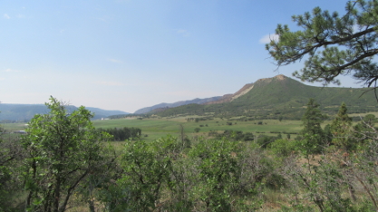
View South from Short Trail by Target Tree Campground
While I was there this time, I discovered where the name came from. In the past, Native American Utes used to pass through the region on hunting trips, and would regularly stop there and camp. While there, they would choose a tree and use it for target practice. Hence the name “Target Tree”, which is a translation of the name that the Utes gave the place in their language.
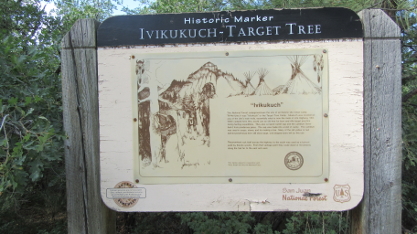
Sign Explaining the Origin of the Name “Target Tree”
On Saturday, I packed up and headed back to Arizona.
August 15 - 17: Arizona
Wildernet – Arizona
Arizona Highways
I finished the trip at the same campground that I started at, Winn. This time, I decided to stay for three days, which would make exactly six weeks on the road, a nice, round figure. Since I had a reservation, I was not concerned with getting there quickly, so I had a nice, leisurely drive to get there.
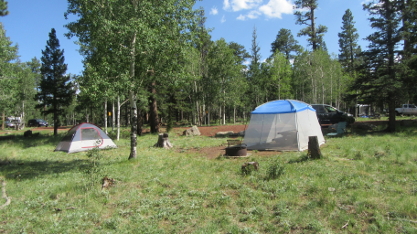
View of Campsite during Second Visit to Winn Campground
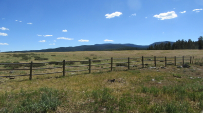
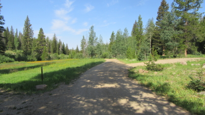
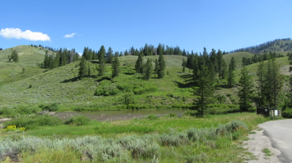
View of Region around Winn Campground from Access Road
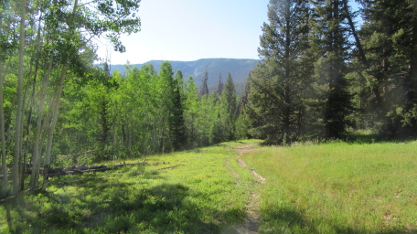
While I was there, I hopped over to the West Baldy trailhead. I first hiked this trail a year or two after Road Trip '86, and returned to it many times. It is one of my favorite trails in the world. I started mid-morning, under a clear blue sky, but by the time I reached my favorite spot on the trail, the sky had clouded over and thunder was rumbling. So I turned back a bit earlier than I really wanted to, rather than get caught in a downpour with lightning flashing all around.
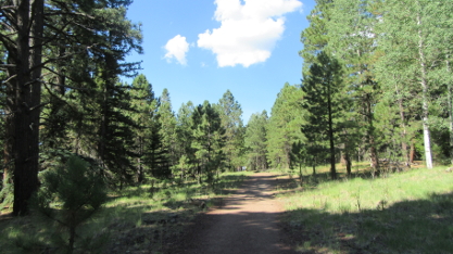
Hiking through Pine Forest near Beginning of West Baldy Trail
View of Original West Baldy Trailhead
Little Colorado River seen from Side Trail off of West Baldy Trail
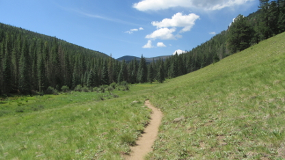
Large Open Meadow further on West Baldy Trail
Finally, on Tuesday morning, I took down my tent and screen house and packed everything away. Knowing that this would be my last morning in the cool, green mountains, I was not in a hurry. I took a last stroll around the campground, then sat at the picnic table and just enjoyed the view. But I knew that I had to get going, so just after 10:00 I said good-bye, started the car, and drove out. By mid-afternoon, I was back home in Tucson.
Compared with most of my camping trips, this one was relatively short. But as I said in the Overview, it was a case of quality instead of quantity. And it served its purpose; I arrived home refreshed and ready to start preparing to return to Brazil.
And in the end, that was what mattered.