Overview
I had originally planned to be back in Brazil at this time. However, due to health issues I was unable to get started with deputation (see the section on Getting the Job Done on the page about Billiard's Work) as soon as I wanted, so I ended up staying in the States. In May, I went up to Wisconsin to visit family. That was a trip in and of itself, going first to Dallas, then out to North Carolina, then up to Wisconsin. And I camped along the way. But in the end I decided that it did not merit a trip report.
I knew I would be coming back to Tucson to finish up before heading back to Brazil. So naturally I considered heading once more into the wilderness with tent and sleeping bag. The only question was: where? My first thought was to do the usual thing and head out to Washington and go down the coast. However, no matter how I tried to arrange it, I always ended up returning to Tucson much later than I wanted.
I was also in touch with some friends in Colorado Springs. And that was what finally decided me on my route. I would do a shorter trip this time, heading out as far as Yellowstone and Grand Teton parks (since my National Parks Pass was good until the end of June!), then go south to Colorado. In between camping in the high country, I would drop in and visit them in the Springs.
And thus was born the name for this trip.
June 17: Wisconsin
Wildernet – Wisconsin
Travel Wisconsin
I left my sister and brother-in-law's house on the 17th of June. I had also been invited to visit some friends in Minnesota, and this altered the timing and direction of my initial drive so that it was much more natural to stop and camp one night in northwestern Wisconsin. So after some research, I ended up staying at Wanoka Lake Campground in the Chequamegon National Forest.
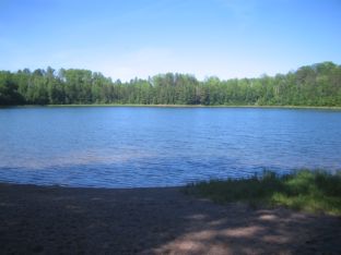
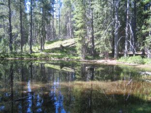
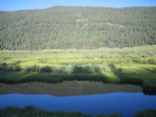
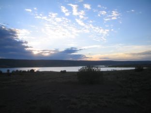
Wanoka Lake
This is a view of the lake as seen from a small boat launch.
The next morning I packed up and headed west to Minnesota.
June 18 - 19: Minnesota
Wildernet – Minnesota
Explore Minnesota
After passing through Duluth, I went west on U.S. Highway 2. Around noon, a bit east of the town of Bemidji, I found a rest area. So I stopped and filled my gut.
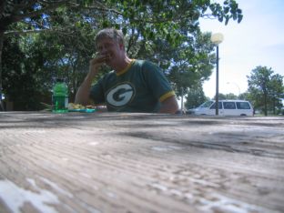
Eating at Rest Area
This is a shot of me filling my belly at the rest area, shot using the timer feature on my camera while it rested on top of the table.
I reached the town of McIntosh an hour or so later, and stopped to visit Dan and Cheryl Jore, who were living north on a side road. I have known the Jores for several years in Brazil, and they were on furlough at the time. I spent a couple of days with them.
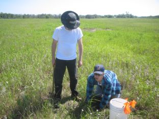
Hunting Gophers
This is Dan and his son Andy, out setting gopher traps to catch the pesky little varmints.
I left the Jores on Monday the 20th, driving along state roads to pick up I-94 going west. While still on the back road I ran into some weather.
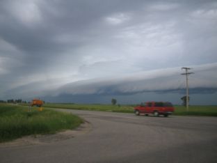
Storm in Western Minnesota
This is a shot I took at a stop sign in rural Minnesota of an approaching storm.
The car got wet, but it wasn't the Wicked Witch of the West, so I made it to the freeway and continued.
June 20 (day only): North Dakota
Wildernet – North Dakota
North Dakota Tourism
Back in the summer of '89 I spent a couple of months in Grand Forks, studying Linguistics. So this wasn't my first time in this state. However, this time I only drove through, stopping in Fargo to change my oil, then just hitting the road and keeping going.
I did get out my camera to take a few shots while passing through Theodore Roosevelt National Park, though.
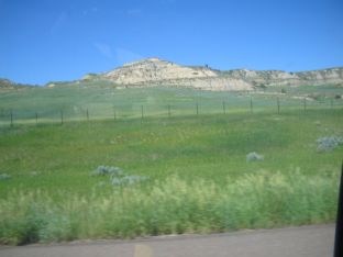
Theodore Roosevelt National Park
I took this shot of some of the prominent rock formations around halfway through.
June 20 - 22: Montana
Wildernet – Montana
Montana's Official State Website
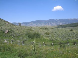
Montana is a state that I keep returning to. This year, it was only to pass through on my way to Yellowstone and then to Colorado, but I did stop and spend a few nights. First, I returned to Red Shale, the campground in Custer National Forest that I stayed at in '04. This year, the area was greener and more overgrown than back then, although the weather at the time of my stay was hotter and drier, with temps in the 90s. But I did stay at the same site.
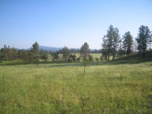
Meadow behind Red Shale campsite
This is the open area down the hill and behind campsite number 2 at Red Shale Campground
I spent two nights at Red Shale, then moved over to Canyon Campground in Gallatin National Forest. This campground is only 16 miles north of Yellowstone, in Yankee Jim Canyon, and is a great jumping off place for visiting the park.
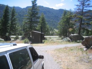
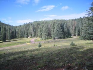
In Front of Canyon Campground
This is a shot looking out the front of the campground from where I parked my car
I stayed at Canyon one night, then headed to Yellowstone.
June 23 - July 5: Wyoming
Wildernet – Wyoming
State of Wyoming
I arrived in Yellowstone National Park early on Thursday, June 23rd. After stopping in Mammoth Hot Springs for a shower, I drove down to Indian Creek Campground and pitched my tent. I stayed at Indian Creek for three nights. On the fourth day I packed up and moved south to Lewis Lake Campground, near the south entrance, because I wanted to be able to pack up quickly and leave early a couple of days later, when I continued on down to Grand Teton.
While I was in Yellowstone, I got up early each day, headed out, and did not return until late. This was my fourth visit to the park, and this time I was determined to get a look at as much as possible. I took around half of my total pictures here. Unfortunately, there is only enough space for a few examples.
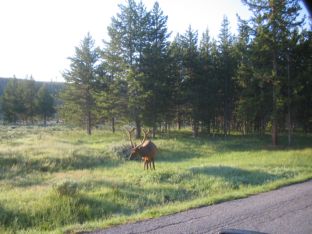
Bull Elk
I caught this shot of a bull elk right outside Indian Creek campground, early in the morning.
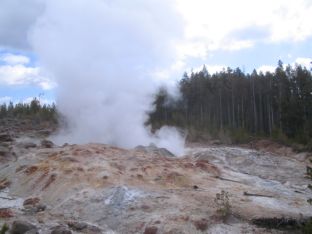
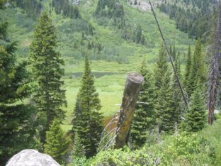
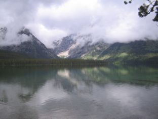
Steamboat Geyser
This famous geyser only erupts big-time around 4 times per century. But it does exhibit smaller eruptions much more often. This was one.
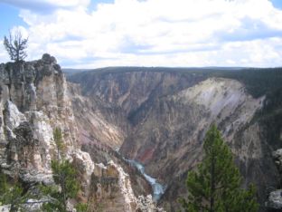
Grand Canyon of the Yellowstone
This is a canyon in which the Yellowstone River flows.
Cascade Lake
This backcountry lake lies a few miles along the Cascade Creek trail. I took this shot while relaxing under a tree in the shade.
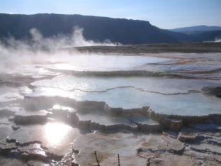
New Blue Spring
This hot spring is one of many at Mammoth Hot Springs.
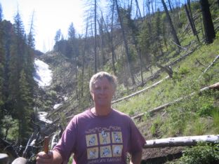
Billiard at Wraith Falls
I ran into a man with his two grandchildren who was kind enough to snap this photo. The waterfall in the background is Wraith Falls.
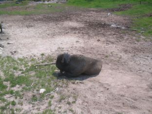
Buffalo Resting
This solitary critter was lying on the ground at the Mud Volcano, chewing its cud. Fortunately, it was by a raised walkway, so there was no danger to tourists.
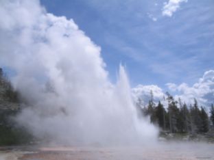
Grand Geyser
I caught this eruption on the return leg of my walk around the Old Faithful area. Some people had been waiting for hours.
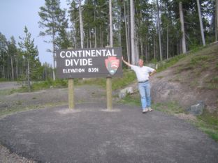
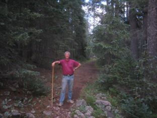
Billiard at Continental Divide
I stopped to get a shot of the Divide, and was fortunate to find another couple doing the same. So we took each other's pictures.
I left Yellowstone on the morning of June 28th, going out the south entrance and directly to Grand Teton National Park. I arrived at Jenny Lake in time to get my name in the queue for a campsite, and within a couple of hours I was set up. That afternoon, I hiked around the perimeter of Jenny Lake.
Moose Ponds Trail
I saw this view back in 2000 and wanted to go down there. Time did not permit at the time. But I vowed to return, and this year I did.
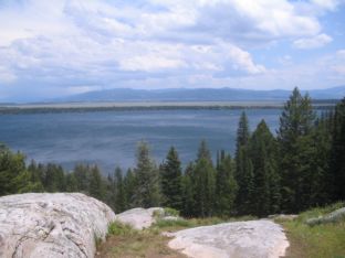
Jenny Lake from West
This is a shot of Jenny Lake seen from the west side. This view looks out from the “foothills” of the Grand Tetons.
Jenny Lake Overlook
I took this shot from the trail, but the Overlook is also a parking spot on the road along the east shore.
The following day I drove a short distance to the String Lake Trailhead and hiked up as far as Bearpaw Lake.
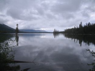
South Leigh Lake
Leigh Lake lies north of String Lake. I thought this was a particularly good view.
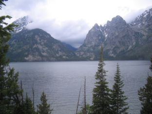
Tetons over Leigh Lake
This is a shot from further north along the shore of Leigh Lake, looking across at the mountains.
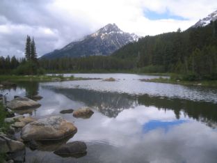
Bearpaw Lake
This is Bearpaw lake, seen from a backcountry campsite on its northeast shore. This may be the best picture of all that I took during this entire trip.
The following morning I left Grand Teton and headed south and east, toward the Medicine Bow National Forest. I had selected a campground, Lost Creek, as a place to stay over the Fourth of July weekend. Lost Creek turned out to be a nice place. (If the name seems familiar to you here on this website, it is the same as the name of the campground in Crater Lake National Park that I stayed at during National Parks Tour '04.)
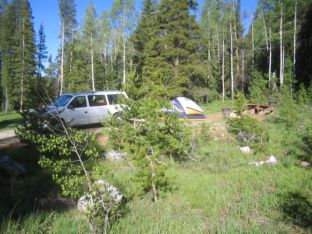
Campsite at Lost Creek
This was my campsite at Lost Creek. Plenty of trees and nice weather. The creek was on the opposite side of the campground.
Another nice thing about Lost Creek was that the Baby Lake Trailhead was right across the highway. I took a hike on the Fourth.
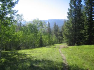
Baby Lake Trail
This is a portion of the trail early on, near the beginning.
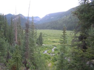
Mountain Pond
The Baby Lake trail passed by this pond, and I thought it would make a nice picture.
On the morning of the 5th, I packed up and drove south into Colorado.
July 5 - 25: Colorado
Wildernet – Colorado
The Official Site of Colorado Tourism
When I entered Colorado, I still was not supposed to show up in Colorado Springs until the following weekend. So I made my way over to Kremmling, then down State Highway 9 to the side road that went along the western shore of Green Mountain Reservoir. I had originally thought to return to Elliot Creek Campground, where I had spent a few nights back during Camping Trip 2000, but I had also gotten some information about another campground called Cataract Creek. Both were in the White River National Forest and were only a few miles from one another. I like the Wildernet picture of Cataract Creek, so on a whim I headed up the road toward that campground—and found three sites available, and liked what I saw.
Looking East from Cataract Creek
This is a view looking east from the campground entrance. The campground lies on the edge of the forest.
After three days I packed everything up and headed down to Colorado Springs. Less than a year earlier, my friends Jim and Julie Powell—whom I knew back in Tucson when they were both in the Singles group at my home church—moved there. Now they had invited me to stop in and visit. While there, they took me around to see some of the sights, such as the Air Force Academy and Garden of the Gods.
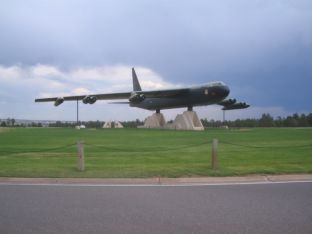
B-52 at Air Force Academy
This genuine retired airplane sits on pedestals by the entrance of the Academy.
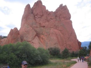
Garden of the Gods
This is just one of the many rock formations at this local park. The head you see at the lower left is Jim.
After leaving Colorado Springs, I headed south and west into the Rio Grande National Forest, where I first spent four nights at Rock Creek Campground. I had expected to find three hiking trails nearby, but was disappointed to only find one, and it was not well marked until you got about a mile into the woods. But it was an enjoyable hike.
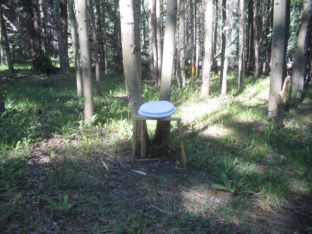
When you gotta go…
I definitely got a good belly laugh when I saw this “throne”, out in the middle of the woods with no signs of civilization anywhere around. Fortunately, I had no need of its services at the time.
After leaving Rock Creek I headed up to Cathedral Campground, also in the Rio Grande forest. This campground turned out to be surprisingly pleasant, with a creek running behind my site and a great view of Cathedral Rock. And the Embargo Creek Trail (which I thought at the time was the Fremont's Camp Trail) was nearby.
Cathedral Rock
This view of the rock is from the open area in the middle of the loop of the campground that I stayed in. My site is hidden behind the trees on the right side of the picture.
When I left Cathedral, I went over to the Gunnison National Forest. I had done some research and had Cebolla Campground on my printed list, but when I got there I was quite unimpressed; it was crowded and there was very little shade. So I went back up the road and checked out Deer Lakes. The campground was much better—years later I continue to have fond memories—and there was an excellent hiking trail in back, the Calf Creek Plateau Trail—which I later on discovered connects with the Brush Creek Trail along its way.
Brush Creek Trail
This is a shot of a meadow along the Brush Creek Trail. I stopped around this point and headed back.
When I left Deer Lakes, it was my intention to go straight to Big Blue Campground, which I thought was in the Gunnison National Forest. However, while I was getting food and ice in Lake City, I discovered radiator fluid dribbling out from under my car. The mechanic said, “water pump!”, and next thing I knew I was spending the night in a private campground while a new water pump was on its way. While in town—since I arrived early and had all day—I looked around. I found a great little Mexican restaurant—the Blue Iguana—saw the historical district, and got to know the place.
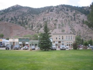
Lake City Historical District
This is part of the historical district of the town, across from the city park.
The water pump arrived the next day. The car was finally fixed, and after one false start I finally got off to Big Blue. When I got there, I discovered that the sign said “Uncompahgre National Forest” instead of Gunnison. Maybe it isn't important, since they are both part of the same administrative unit.
While there, I walked a half-mile up the road from the campground and hiked the Big Blue Trail.
Near Big Blue Campground
I took this shot one morning just up the road from the campground. The entire valley is a quagmire of marshy ponds.
Big Blue Trail
This is a shot of the valley of the Big Blue, seen a ways upstream along the trail. You can see the creek down below.
On the 25th, I left Big Blue. I made my way back through Lake City, then down to U.S. Highway 160 and west, through Wolf Creek Pass, until I left Colorado at the Four Corners area.
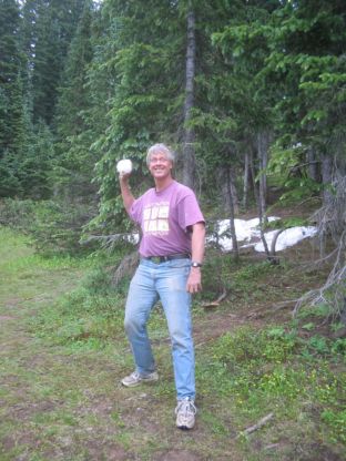
Throwing a Snowball
I talked a fellow tourist into snapping this shot of me with a snowball, at Wolf Creek Pass. Afterward, I threw it—but not at her!
July 25 (day only): Four Corners
Four Corners National Monument
I arrived in the Four Corners area in the early-middle afternoon. I had been here before, ten years ago (see Farewell Tour '95), but did not have a camera that time. This time, I did not place a can of Coke on the spot before guzzling it. Instead, I placed myself on the spot and had someone snap a picture with my camera.
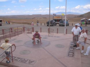
Billiard in Four States
I saw a couple of other people doing this and getting their picture taken by friends. Since I didn't have anyone with me, I asked a stranger, who was perfectly happy to snap this shot.
July 25 - 31: Arizona
Wildernet – Arizona
Arizona Highways
When I left Four Corners, I headed down U.S. Highway 191 through the Navajo Nation, which occupies a considerable portion of northeastern Arizona. South of the reservation and Interstate 40, I came to Lyman Lake State Park, where I camped for the night.
Sunrise over Lyman Lake
I took this shot just before going to take my morning shower. The sun was just starting to come out from behind the clouds.
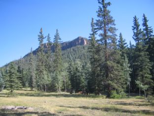
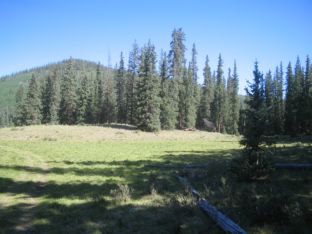
The next morning I continued south into the Apache National Forest, where I found a campsite at Winn Campground. I stayed two nights because I wanted to go hiking on the West Baldy Trail, which was just up the road. Normally I stay at Big Lake, but the road was so appallingly bad this year that I didn't want to drive any more than necessary over it.
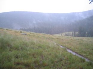
Meadow on West Baldy Trail
As you can see, it was rather wet at the time I took this shot. This is my favorite part of this entire trail; in good weather I like to picnic in the pine trees on the left side of the picture.
When I left Winn, I stopped briefly at Big Lake for a shower, then drove the back road to Alpine. Some 27 miles south of Alpine, I found a campsite at KP Cienega, which is still my favorite campground in the whole country.
KP Cienega Campground
This shot was taken from the hillside just outside the campground, looking down at the entrance.
While at KP, I made a point of hiking up to Blue Vista, a nearby overlook accessible by foot from the campground, as well as going down KP Trail, which follows KP Creek, as far as the waterfall.
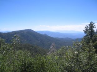
East from Blue Vista
This is a view looking east from Blue Vista, near KP Cienega
Billiard on KP Trail
I took a short “pre-hike” to show some other campers the trail, and they were kind enough to snap this for me
Finally, on the 1st of August, I packed up everything and headed down to Tucson. The trip was over, and it was time to return to civilization.